Bus Trip to Mars |
|
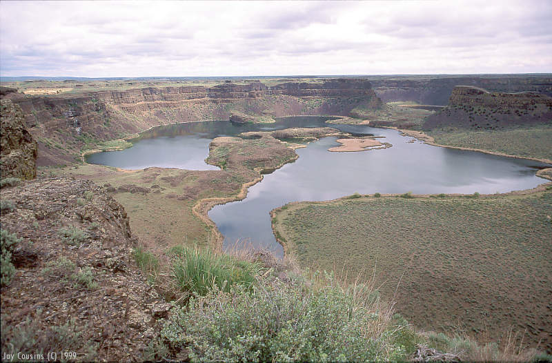
Mars comes to Earth in central Washington state. The bones of one of the largest waterfalls in geologic history rest here. Created by repeated floods of tremendous proportions, Dry Falls is 3.5 miles wide and over 400' in height. The only other place that such a feature is found, is on Mars. Prior to the Mars Rover being sent on its Pathfinder mission to Mars, it was tested in this area because of the striking similarities to sections of Mars that were being considered for exploration. |
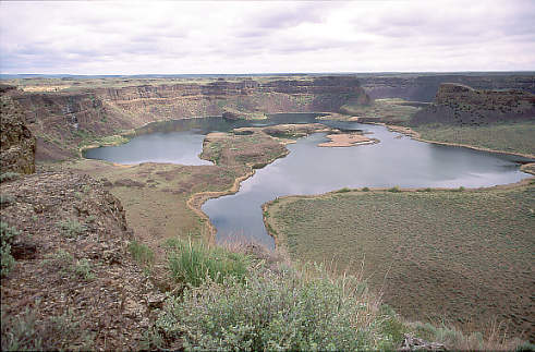 Looking north toward the falls, one can see about a mile of the sheer drop. The remaining 2.5 miles is hidden behind the large outcropping on the right-hand side of the photograph. A larger version of this photograph, suitable for converting to a screen image for wallpaper is available. Once downloaded, the image should be loaded into a paint program and saved as a .bmp format file. It is designed for a screen resolution of 800x600. Download=87k |
Toward the end of the last ice age, from about 25,000 to 12,500 years ago, there were numerous floods that washed over eastern and central Washington. The best documented source of some of these floods is from a huge lake in western Montana called Lake Missoula. An ice dam formed the barrier to the lake's outlet; with warming temperatures and rising waters, eventually the dam burst releasing a catastrophic flood. As the wall of water, up to 2000' feet high, smashed its way to the Pacific ocean, it swept away everything in its path. The action of the water eroded the underlying basalt, carving channels and creating the geologic feature that we see today as Dry Falls. If one could have stood above the flood at its height and observed the falls, all that would have been noticeable would have been a slight dip in the surface of the water as beneath the surface it poured over the 400' drop. |
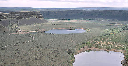 Looking south from the area of Dry Falls, one can see the horizontal striations, caused by various floods, that have been eroded into the coulee on the left side of the photograph. A more complete explanation of these geologic events can be found here. Please use your browser's back button to return to this page. |
Dry Falls-Tour Start I Dry Falls-Page 2 I Channled Scablands-Potholes-Page 3 Channled Scablands-Potholes-Page 4 I Tour Information |
ASTROCON-Info E-mail Us Your Convention Questions